

Namibia tourists who wanted to visit Sossusvlei yesterday needed plenty of patience. After heavy rains, the Tsauchab Rivier (dry river) flowed at full capacity in its catchment area. The floodwaters even reached the off-road track into Sossusvlei.
Even the drive to the Namib-Naukluft Park near Sesriem on the gravel road C19 was a challenge. The Tsondab Rivier near Solitaire forced drivers to take the 20 km detour via the bridge at Ababis.
Almost all the other riviere along the C19 route were also flowing. Some could only be crossed safely after carefully wading through the floodwaters and assessing the depth. But even then, there was a risk of the vehicle getting stuck and being swept away by the rising tide.
Yesterday morning, Sesriem Canyon could only be viewed from above. The Tsauchab River roared through the narrow gorge, raising hopes of a rare natural spectacle. When the water level is high enough, the Tsauchab reaches Sossusvlei. The clay pan amidst the world's highest dunes will then be transformed into a lake.
About 20 km downstream, the floodwaters were still so strong that cars could not cross the river for hours, despite the concrete ford. Only when the water level receded was it possible to attempt the crossing.
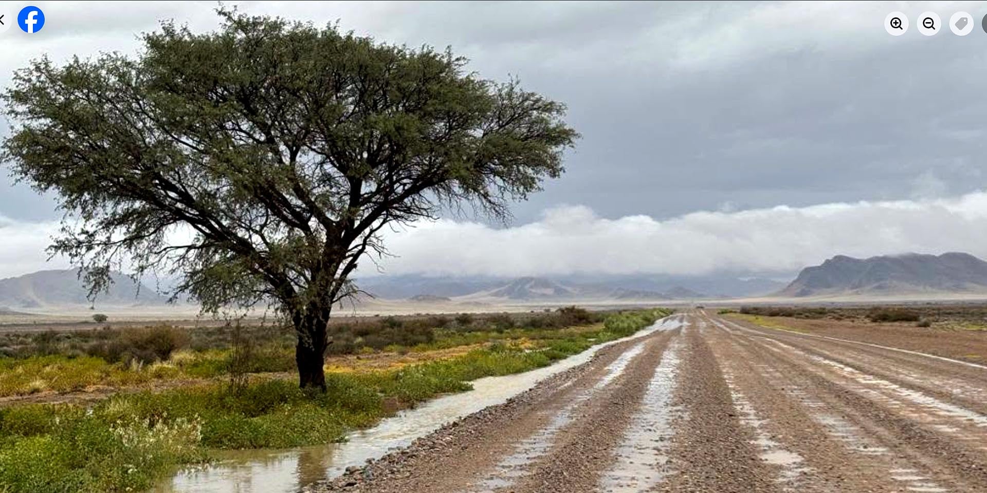
For many, the journey ended at the parking area for city vehicles, about 5 km before Sossusvlei. The Tsauchab's waters had already flooded the off-road track that runs in its bed.
Attempting to continue, some got their four-wheel-drive vehicles stuck in the wet sand and mud. Others walked, taking advantage of the opportunity to capture unusual photos of water in the desert. For many Namibians, too, this is a 'once in a lifetime' experience.

Extra adventure on the way to Sossusvlei: crossing the flowing Tsauchab Rivier (dry river). Photo: Screenshot from a Facebook Reel by Gondwana Collection Namibia
Water levels rise in some Namibian reservoirs
Other areas in southern and central Namibia also received heavy rainfall. Meteorologists had warned of torrential downpours due to a 'rain belt'. Several gravel roads were temporarily impassable because of floodwaters from crossing rivers.
Farmers are pleased with the late rain. It allows the grass to grow vigorously before the cooler weather in May and the onset of winter in June.
City dwellers are relieved that there were heavy rainfalls at the end of March and beginning of April. Torrential rain is needed to replenish the reservoirs that ensure the drinking water supply.
However, almost only the reservoirs in the south of the country received water over Easter. According to water supplier NamWater (see today's Economist report), the Hardap Dam near Mariental is now almost 60 percent full.
The Naute Dam south of Keetmanshoop reported a fill level of 95.5 percent. The Neckartal Dam west of Keetmanshoop, by far the largest in Namibia, has been overflowing for days (see the Facebook reel from the online newspaper Informanté).
In contrast, the reservoirs in the central part of the country, which supply Windhoek with drinking water, reported only minimal inflow. Von Bach and Swakoppoort Dams east and south of Okahandja are 70 and 80 percent full, respectively. The majority of this is due to the exceptionally good rainy season a year ago.
More photos and video clips of rain and rivers can be found on the Facebook pages Reën in Namibia, Namibië Reën / Weer and Gondwana Collection Namibia.


.png?width=82&height=85&name=Navigate%20Namibia-03%20(1).png "Navigate Namibia")
SUBMIT YOUR COMMENT